jiggity jig!! says the familiar nursery rhyme. Tuesday, June 13th we were definitely on our final leg of our trail. Our final goal wasn't Salt Lake City or the Willamette Valley of Oregon. We were heading home to Syracuse. But we did manage to find a few more things to see along the way....
Our neighborhood antelope spent the night so he could say good-bye as we headed out of the Missionary Camp.
The Sweetwater River winds back and forth in the meadows and valleys of the mountains.
Mountains and more mountains to the west.....
Split Rock was anther well known landmark that the travelers used to judge their distance along the trail. It is a cleft in the Rattlesnake Range.
The Ice Slough---like I mentioned we were stopping at almost any brown sign we could see as we traveled through Wyoming. About 5 miles east of this marker was a small stream that flowed into the Sweetwater River. Because of the unique mud and formations of marshes around it, it would often have ice into June and sometimes into July. Travelers would chop blocks of it to take with them. I can imagine ice would be a desired treat during their journey. My great grandfather talked about climbing up to get some snow along his journey west. I was just grateful for my air conditioning.
The blue skies are pretty but it would have meant a hot day of traveling for pioneers along the trail in July and August.
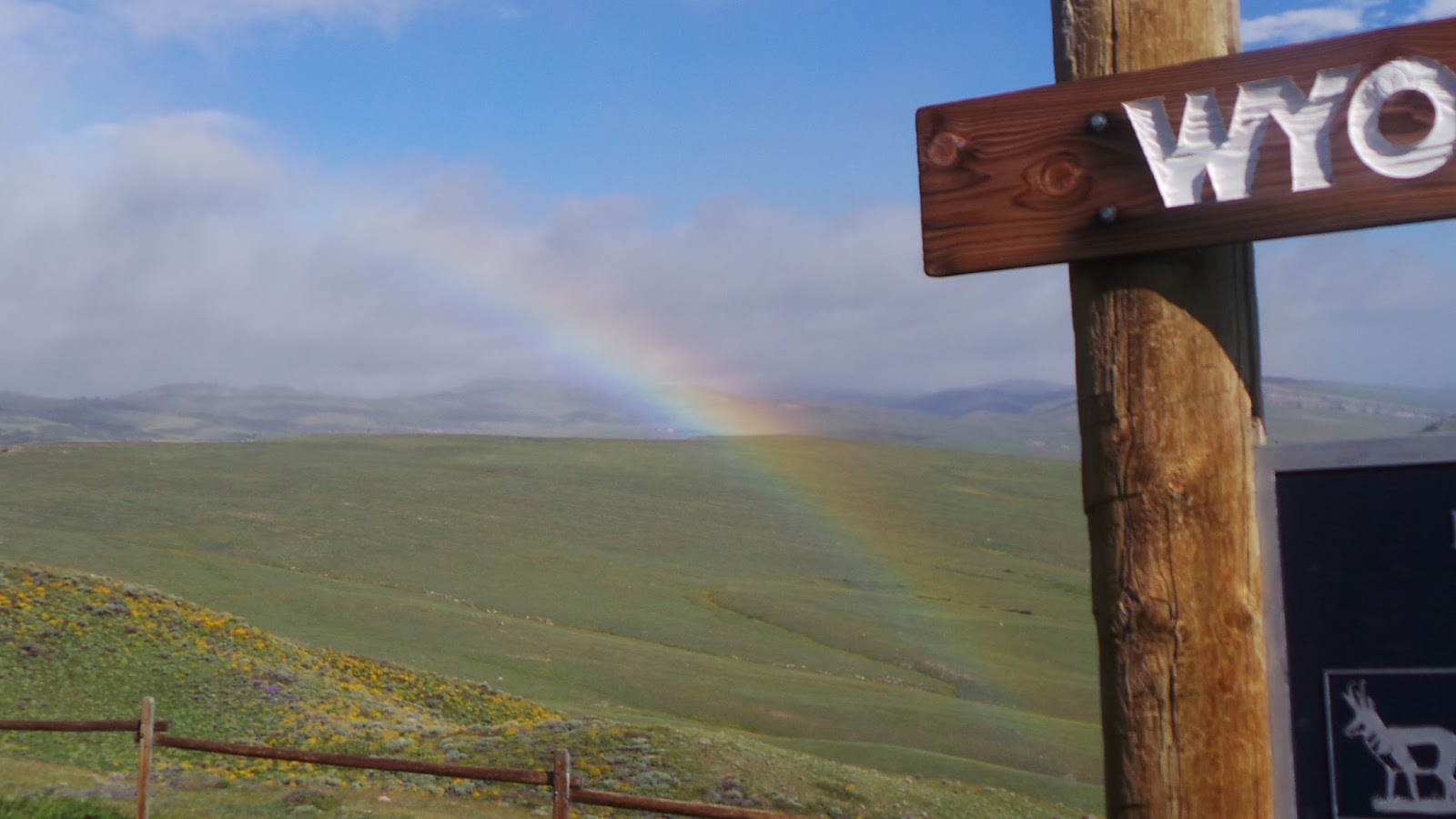
We had some light rain and we had this beautiful rainbow to the west.
Wyoming was not only a place for the pioneers to cross but it is home to many types of wildlife.
I actually didn't know that central Wyoming was so gorgeous.
Fading rainbow a few miles down the highway at another marker.
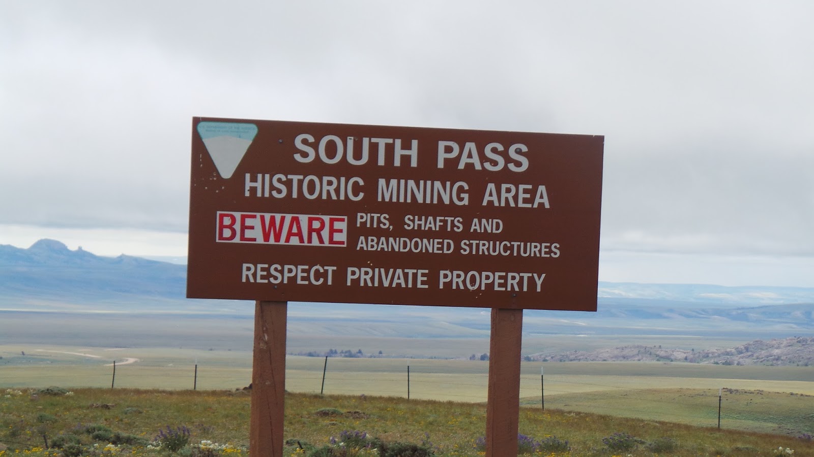
We headed onto a dirt road as we were looking for the South Pass. It had snow still on the ground in mid-June.
AN old mining town....
And the road is closed to South Pass City so we had to back track to Highway 28....too bad that hadn't posted that when we got off the highway in the first place.
We headed back and around another way and made it to South Pass City. It became a very busy mining town when gold was discovered nearby in 1867. Prior to that time, South Pass was the major pass though the Rock Mountain of the Rockies Mountains and it is estimated that over 500,00 settlers past through this past during their journeys west.


"July 8 We left Sweetwater, Traveled 6 or 7 M's & came to the Pacific Springs, On the Summit of the Rocky Mountains. The water from those springs ran West toward the Pacific Ocean, hence the name. All hands had to take a drink at on or the other of those Springs because the water was going our way though not nearly so good, & refreshing as our last drink from Sweetwater that was following our back track. The only Two business places at Southpass were a Small Trading post & an Ox Shoeing device. There the Ox was swung up bodily without consulting his wishes, giving the Stalwart Blacksmith all the advantages. After satisfying ourselves with sight seeing we moved on having before us 20 miles more to travel before coming to water which we found in little Sandy about eleven Oclock in the night, the longest days drive our teams made during our whole trip." great grandfather's journal
I liked how he mentioned that they all wanted to drink from the Pacific Spring "because the water was going our way". Maybe that is why I wanted to touch the Mississippi River and other special spots, because my great-grandfather was sentimental like that as well.
We also were "sight seeing" at the spot and thinking about him and the many other pioneers along this journey.
THe buildings were left from the mining time.....
Back on the road again, this is coming down from the South Pass and heading south west...
This sign marks the Lander Cutoff which shortened the Oregon trail by almost 7 days. It was not developed until 1858 which meant that my great grand father and great great uncle did not take this short cut on their journey.
I loved the top of the sign......
The Big Sandy River was a natural stop for the travelers as it provided much needed water after leaving the South Pass area.
My great great uncle talked about traveling at night during the section from the South Pass to the Little and then Big Sunday Rivers. Then he wrote:
From the top of the highland we saw the stream
Each driver had hard work to control his team
Fully three miles off they smelled the water
And each thirsty ox became a trotter.
Off down that long mountain, it was no childs play
To keep them from bolting and running away.
A prod with the goad stick, loudly yelling gee-haw
To the lead and the wheel in a perfect see-saw"
He went on to report that they made it safely to the river and the oxen were so anxious for water that as soon as they were released from the wagon they headed for water even though they were still yoked together.
It wasn't just the humans who suffered along the trail. The oxen, horses, and cows that traveled with them also came their all on the journey.
This marker was set in position to indicate the spot near which Brigham Young and the first wagon trail of Mormon pioneers met Jim Bridger to discuss the possibility of the Mormons settling in the Salt Lake Valley. It has been said that Jim Bridger tried to discourage the Saints from settling there because he felt it won't be a good place supporting settlements. Supposedly he said that he would pay $1000 for the first bushel of corn grown in the valley.
We had seen so many antelope throughout our travels today through Wyoming so we took this sign very seriously.
And on to the Green River which was another place that my great grandfather mentioned. He camped along the Green River on July 9th, 1853.
The Lombard Ferry was located near this area of the Green River and was one of the most used Ferry crossing on the route. Although it was started by mountain men, during the 1850s it was run by the Mormons and provided both passage for the pioneers and also revenue for the developing settlements in Utah.
Sometimes pioneers would decided to ford the river instead of paying the fee. It was a dangerous gamble which worked for some but many people and animals were also lost here as well as in other river passages along the way.
A number of years ago, someone built this replica of the Lombard Ferry. Again it is amazing how small they were. It could take a few days to get a whole wagon train across the river by ferry.
The Green River......
We didn't actually go into Ft. Bridger. We have been there a few times over the years on trips to nearby Flaming Gorge and we were running short of time since I had to go to school that afternoon. It looks like they have expanded the site and built some additional buildings. Ft. Bridger was the last out post for the Mormon pioneers as they broke away from the other trails and headed toward the Salt Lake VAlley.
We took this pictures and then headed back on the road toward Syracuse. I drove the last part of the journey (except pulling into our driveway and parking the RV on the side of the house. I let Gary do that.) I didn't get any pictures of the beautiful scenery along Echo Canyon as we entered into Utah.
I grabbed this one off the free stock photos on the internet to finish our trip.
And around 3:00 p.m. we arrived in Syracuse which was just enough time to clean out the RV, take a shower and head for class.
That was a lot to do in a week between classes!!! I love road trips and this was one of the best!!!


No comments:
Post a Comment