Sunday, July 2, 2017

Garden Grove

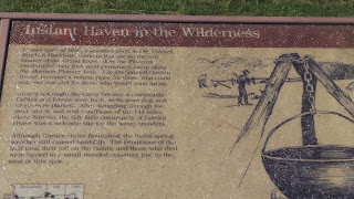
No problem finding our next location.  There is actually still a town called Garden Grove near by where the Saints stopped and started building a temporary way station for the Saints who were coming behind them. They dug wells, built houses, bridges, and fenced and plowed and planted crops.  That is one unique aspect of the Mormon Trail was that the Saints were preparing a route for those who were coming behind them.  Instead of simply forging ahead, they would stop and build bridges and plant crops, etc. which would last for the wagon trains coming behind.


Here are some pictures from the historical part of Garden Grove
This area to the south of the markers were part of the cemetery for the pioneers.  Unfortunately as they traveled, many Saints lost their lives due to exposure, illnesses, accidents and other factors. It was a difficult journey for which many were not prepared for.

I think I saw many more signs for the Mormon Trail in Iowa and Nebraska than I have ever seen in Utah.  These were around Garden Grove.


Sugar Creek Camp and beyond

Well, actually we couldn't find it.  Turns out that our GPS on our phones didn't work in the hills of southern Iowa (alert for future travelers) and our map directions were not adequate to find this spot. After the early pioneers left Nauvoo in February of 1846, they traveled northwest to this location and made camp for a couple of months.  Brigham Young and others traveled back and forth from this location to Nauvoo to help with the organization of the bulk of the Saints who were leaving Nauvoo later in the spring.  By the time, Brigham Young and the first of the Saints left this site the encampment had grown to about 2500 men, women, and children--much larger than the 1800 Brigham Young had wanted.

Ely Ford Mormon Trail Crossing is located in the beautiful Lacey-Keosauque State Park.  As we entered into the State Park we couldn't find anywhere to get a map of the area and we wandered a bit around the park which is beautiful as advertised on our map.  I was ready to call it quits when Gary tried one more road and we found it.  This was a location where the Saints crossed the Des Moines River.


 A small bridge unrelated to the pioneers which led to one of the many trails through this State Park.
When I would look at the river banks along the many rivers we saw along this trip, I was often struck about how hard it would be to pull horses, oxen and wagons up and over on to the land.  Even to walk from the river up these banks would often be a struggle.

 And in the honest of blogging, Gary would harass me if I didn't tell you about this little "map incident".  As we decided how to leave the park, I suggested that we take the road going directly south rather than heading north and back around on the roads we had already been on.  As we headed down the road, I commented that I thought we might be traveling on a small bridge across the lake.  When GAry asked me why, I said, "Because I can see a road on one side of the lake and on the other side, but it doesn't show anything across the lake".  I think Gary started laughing then but drove on.......

and here is the end of the road that we were traveling on.......

 and here is the other section of the road.....

with the lake in the middle.  Gary thought that was hilarious that I thought there might be a bridge. Actually it turned out the pioneers crossed here as well


We however didn't cross here, but backtracked and took the long way around that didn't require fording a lake or building a ferry for the RV......we are lame pioneers!!!

Our next planned stop (noticed the key word "planned") was Locust Creek Camp.  This was the location that William Clayton wrote the hymn "Come Come Ye Saints."  The story is that he had heard about the birth of his son back in Nauvoo and wrote this song which became the anthem of the pioneers as they traveled across the plains.  One pamphlet stated that it was tradition if anyone started to sing the hymn then all in the company would join in the singing, no matter how tired or cold and hungry they were.

The map indicated that it was one mile south of this small town.  It is somewhat hard to determine exactly one mile from a town because when does that measurement actually start?  We kept driving assuming that there would be a brown historical marker to show us the way.

Wrong-----however after about 2 miles we did see a big sign that advertised "Mormon Trail Handicrafts".  That sounded promising.  Afterall, wouldn't you put such a store near the trail and an important spot.  We turned along the designated road which quickly became a dirt and gravel road and headed through the country side of Iowa....and we drove and drove and drove...up hills and down.....around corner and over railroad tracks....and never found the spot (or the store).

We did see a number of the Mennonite farmers who live in this area.  I think they (especially the children) were surprised to see a RV driving down these dirt roads but maybe they are used to these "odd Mormons" who do this type of thing.
as we were driving down the road from the RV


In some literature we got the next day from Winter Quarters, it looks like we likely drove very nearby the spot.  It isn't marked and is located on the west side of a cemetery. Although we didn't see it, I loved the drive through these hills.

Montrose Crossing

 Montrose Crossing (or Landing which it is sometimes called) is the spot where the Saints from Nauvoo landed after they crossed the Mississippi River.  It is still a small landing with a dock for fishing boats.  The river is about 1 miles across from here.

One of the first brown historical markers--The Mormon Pioneer Trail

 Looking back across the river to Nauvoo---

Jena and I touching the other side of the river
With my camera's lense, I can see the temple across the way fairly easily.  If you know what you are looking for, you can barely make it out with the "naked eye".  Many Saints recorded in journals that their last look of Nauvoo was from this point and seeing the temple on the hillside.  How happy they must be to see that temple again sitting on that hillside!  Newel Knight (April 24, 1846) "We all halted & took a farewell view of our delightful City...We also beheld the magnificent Temple rearing its lofty tower towards the heavens."

 I liked this sign on the corner in Montrose.  "Nauvoo by land  25 miles"....

 ..."Nauvoo by boat 2 miles"
Using our Iowa map with the "Auto" tour outlined, we headed somewhat northwest from Montrose through the beautiful countryside of southern Iowa
Our next stop-  "Sugar Creek Camp"

On the trail again

Saturday morning, we headed out on our own trek west.  However instead of taking the smooth highways and speedy interstate, we headed back across the Mississippi River and then south again through Lincoln City to Montrose Crossing.....

Montrose Crossing was the place that the Saints entered into Iowa after crossing the Mississippi River.  Whether by ferry as many of the wagons did or those who crossed on the frozen river, this was the location of their landing and the beginning of their journey.  Our goal for the next four days was to follow the path of the Mormon and Oregon trails as they traveled through Iowa, Nebraska, Wyoming, and into Utah.  Using some maps we had gathered, our "Maps" aps on our phones, and watching for the brown historical signs along the way, we hoped to be reminded of the past and strengthen our connections with those who had traveled before us.

In Iowa and Nebraska, there are signs for the "Auto Tour" of the Oregon, Mormon, and Pony Express trails.  This tour did not go exactly the path of any of the trails as that won't be possible.  Modern roads didn't have to avoid certain parts of rivers or inclines too steep for oxen to climb so they take a much more direct way that those traveling by wagon or horse.  However this auto tour traveled nearby the trails and many of the sights we wanted to see were near by a few miles from the road.

Again, a reminder:  I took over 2000 photos and I love history.  I know you have seen a lot from Nauvoo but I am only getting started.  We had four days where we traveled, stopped, took pictures, hopped back in the RV and traveled some more and repeated the process.  We stopped along the road for most of the brown historical markers along the way (Some were great and others seemed out of place, but all part of the adventure.)  And along the way, we not only saw bits of history that we were looking for, but we also had a touch of life today as well.

So enjoy the journey as we travel again the Mormon and Oregon Trails!

(Sidenote:  People have asked me if we recommend this trip to other people.  The answer is "it depends".  You must enjoy driving in the car on side roads, through little towns, and miles of dirt roads.  You must be okay that you missed a spot that you hoped to see and experience.  And you can't be in a hurry--because it really isn't a hurrying type of vacation.  If you fit the above description, come on over and we will share our maps, etc. with you.  If not, read a book about pioneers' journeys or simply read our blog.)